 Explore Maharashtra
Stepwells and the British Raj: colonial maps and field evidence
In British India, surveying water structures became part of a larger exercise: understanding land, revenue, settlement and movement. Stepwells—bawdis, baolis, vavs, kunds and baravs—were recorded in village surveys, topographic sheets, district gazetteers and archaeological reports. These papers can identify a structure’s location, name, depth, access and relationship to roads or cultivation. They also reveal how officials understood water as a governed resource. Yet a neat map symbol or gazetteer sentence can hide seasonal use, local stewardship, labour histories and physical change.
For Maharashtra, where stepwells are being re-evaluated amid drought and groundwater pressures, archival records work best beside present-day evidence. Historical maps suggest where to search; photographs and drone images test what survives; residents may know a structure under a name absent from official papers. The strongest histories separate what a record states from what its makers assumed, preserving contradictions and absences rather than forcing every source into one smooth account.
Revenue surveys and the mapping of water
Revenue surveys produced the earliest consistent paper trail for many villages under British administration. Surveyors listed tanks, wells and reservoirs alongside fields, houses, shrines and markets. A stepwell might be valued for irrigation or drinking water, yet described through a local name later rendered in an unfamiliar spelling. Such entries are administrative fragments, not architectural surveys: they may note whether a structure worked without recording its steps, chambers or sculpture. Even so, its place in the revenue landscape reveals how settlements were organised around water.
Topographic mapping added distance and direction. The Survey of India’s triangulation and later revisions tied villages to railways, hills, canals and district headquarters. On a sheet, a stepwell becomes part of a network rather than an isolated monument. Symbols separate masonry tanks from masonry wells, while spot heights and contours reconstruct the surrounding terrain. Handwritten annotations may record repairs, access notes or residents’ objections. Researchers should treat one sheet as a snapshot in a changing cartographic process.
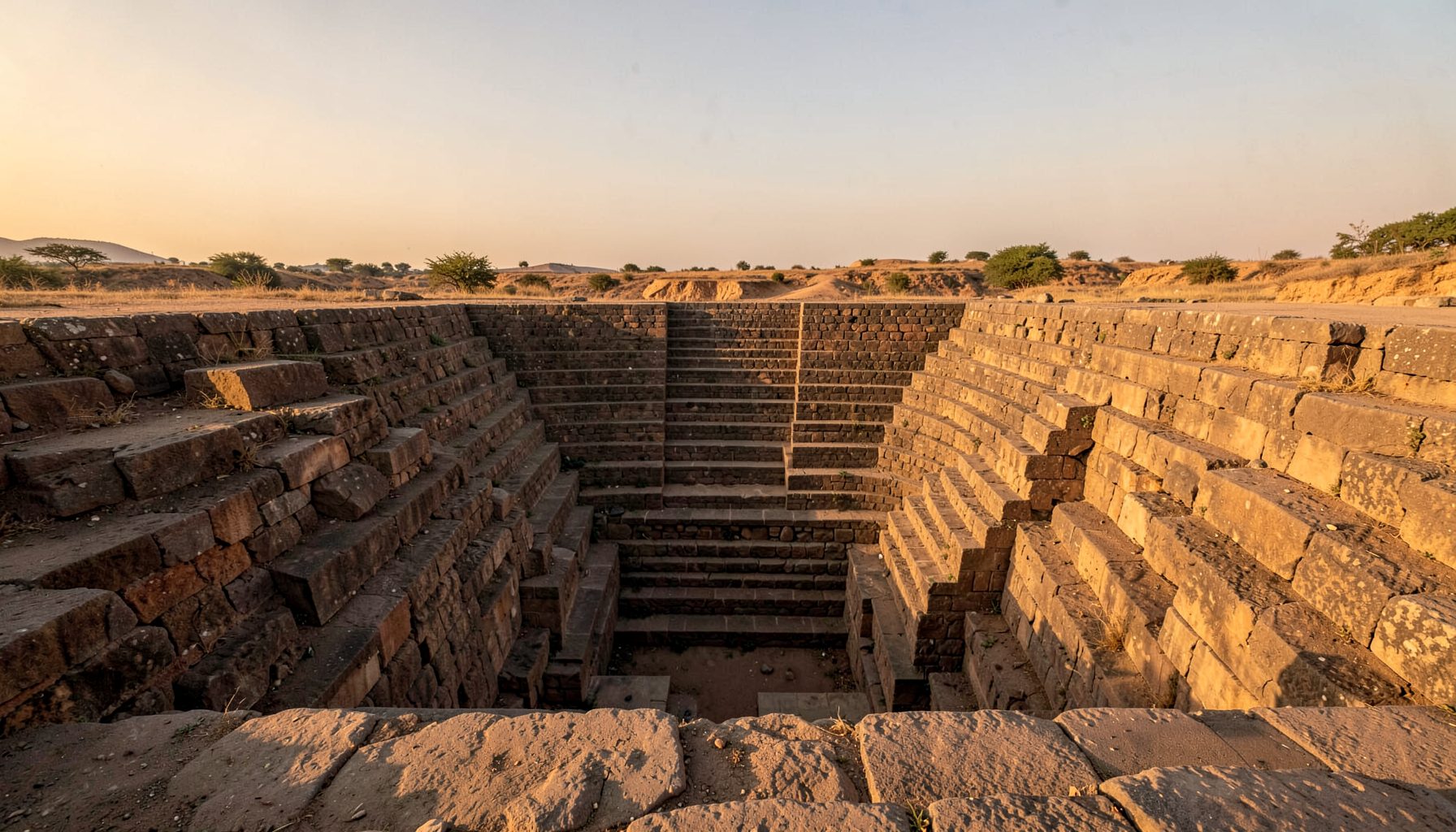
Modern interpretation benefits from keeping records in sequence and alongside field evidence. That is the purpose of the Indian Stepwells project, which combines original photography, architectural sketches, aerial documentation and research into Maharashtra’s stepwells. Its invitation to local communities to identify undocumented structures is especially valuable, since a weathered platform, village pond or terraced descent may not resemble a “stepwell” in a colonial index. Archive and memory can direct fieldwork rather than replace it.
Railways, ports and the widening survey
Railway expansion made the survey of water infrastructure more urgent and politically charged. Lines to Bombay, the Deccan and the Konkan linked markets, ports, cantonments and pilgrimage centres, while the Great Indian Peninsula Railway altered the ground around older wells and tanks. Surveyors mapped stations and alignments carefully, but nearby water sources mattered to track workers, animals, passengers and military supply. A structure beside a rail line may sit within a layered history of extraction, mobility and urban growth.
The Konkan makes this relationship visible. Coastal routes and later rail construction cross a landscape where water architecture supported travel, settlement and monsoon management. The account of Konkan railway corridor documents vulnerable structures before development pressure and deterioration make them harder to record. Its importance is not simply that a railway threatened heritage: old alignments, quarrying, road building and changing drainage also alter the context that gives a stepwell meaning.
Ports and administrative centres sharpened another pattern: the best-mapped sites were often those officials could visit, tax or deploy for public works. Less accessible structures, including those serving dispersed farming communities, could receive only a passing mention. Imperial records combine valuable documentation with uneven attention. Cross-referencing railway plans, inspection reports and revenue books can reveal which sites were strategically important, then ask whose needs were absent from that calculation.
Gazetteers, archaeology and colonial categories
District gazetteers compiled in the late nineteenth and early twentieth centuries turned such fragments into readable prose. Their “antiquities” and public-works sections often named stepwells, described access and repeated local traditions, but were written for administrators. Boilerplate could be copied between districts, turning oral knowledge into apparently authoritative text. Researchers can use that repetition to show what officials wanted to standardise, while checking older surveys and vernacular sources for differing versions.
Archaeological surveys offered measured drawings, elevations and photographs. Under colonial auspices, the Archaeological Survey of India catalogued monuments within an evolving conservation system, giving many stepwells documentary forms that survive in institutional reports. Its categories were useful, but terms such as “tank”, “well” and “ruin” did not always capture the social life of a stepped reservoir. A report focused on masonry and date may say little about who collected water, maintained it, or shaped access through gender and caste.
Location can acquire symbolic meaning after survey, as the contested public memory around Michael Collins’s grave in Glasnevin demonstrates. A mapped point can become a site of ceremony, dispute, tourism and political argument. The parallel explains why stepwell maps should be read beyond their immediate purpose. Names, boundaries and descriptions preserve power relationships, while later commemorations can redirect a place’s significance.
Reading old maps from an Australian perspective
For Australian researchers, these records sit within a familiar network of public institutions. The National Library of Australia in Canberra provides Trove and overseas holdings, while the National Archives of Australia preserves Commonwealth records; Sydney’s State Library and Mitchell Library offer major map collections. Libraries and historical societies across Melbourne, Adelaide, Brisbane, Perth and regional centres hold material outside national systems. Digitised catalogues aid discovery, though map requests may still involve a library card, postcode and handling fee.
Australian heritage practice offers another frame. State and local government listings, conservation areas and council permits determine how sites are managed, and heritage consultants translate archival reports into statements of significance. Public debate uses familiar phrases such as “local studies”, “heritage register” and “community consultation”, although their meaning differs across jurisdictions and between private owners and public bodies. The research market includes universities, museums, architects, planners, film crews and tourism operators, often working through grants or commissions rather than one national heritage agency.
A specialist archive also competes for attention in a busy media market, where Australian audiences may encounter heritage through popular formats before a survey sheet. The site’s guide to multihand blackjack in Australia shows how rules, venues and local expectations can frame an international subject for this audience. The subject is commercially unrelated to stepwells, yet the approach illustrates a publishing strategy: connect specialist research to recognisable Australian habits without confusing entertainment with historical argument.
Preservation through records and local knowledge
The practical value of colonial survey records is to make fieldwork more exact and interpretations more accountable. Old coordinates can be georeferenced against present maps, then compared with satellite imagery and drone photographs. A discrepancy may indicate a relocated structure, changed spelling, old route or map error; each needs different evidence. A responsible record notes the sheet, scale, date, legend and uncertainty, and checks access, ownership and environmental condition. It also asks whether a structure visible in 1868 remains visible today.
Climate shapes both archive and visit. Monsoon rain can close a descent, flood a chamber or make a remote approach dangerous, while summer heat alters working hours and weakens paper and stone. Australian museums face seasonal constraints, from Melbourne’s changeable weather to storm and heat risks in northern cities, so indoor interpretation and timed access are familiar practices. The value of rainy-day memorial programmes is in offering meaningful alternatives when a heritage route cannot be accessed normally.
Local knowledge is the final layer. Residents can identify vanished tanks, explain altered alignments and record names absent from British documents; oral histories can reveal restrictions and uses overlooked by surveyors. Community contributors should be credited, and sensitive details should remain with the people who supply them. This approach treats preservation as an ongoing relationship between maps, monuments, visitors and custodians rather than a transfer of documents into a museum. When the layers are allowed to disagree, stepwells emerge as living infrastructure shaped by climate, administration, mobility and collective care.
Get in Touch
Have information about a stepwell that is not yet on our map? We would be glad to document it and give you full credit. Whether it is a Barav, Kund, Vihir, or any other form of stepwell, every contribution helps preserve India's water heritage.
Call or message us with details about the location, and we will follow up.
#9372496819
Send a Message
What People Say
"The Maharashtra Stepwells campaign has brought attention to structures that were nearly forgotten. The architectural documentation and drone photography are invaluable resources for researchers and students alike."
"Collaborating with the Indian Stepwells team gave our architecture students hands-on exposure to traditional water-harvesting structures. The presentations were insightful and inspiring."
"I shared details of a stepwell near my village that was not on any map. The team visited, documented it beautifully, and credited me. It felt wonderful to contribute."