 Explore Maharashtra
Stepwells and the Future of Heritage Documentation in India
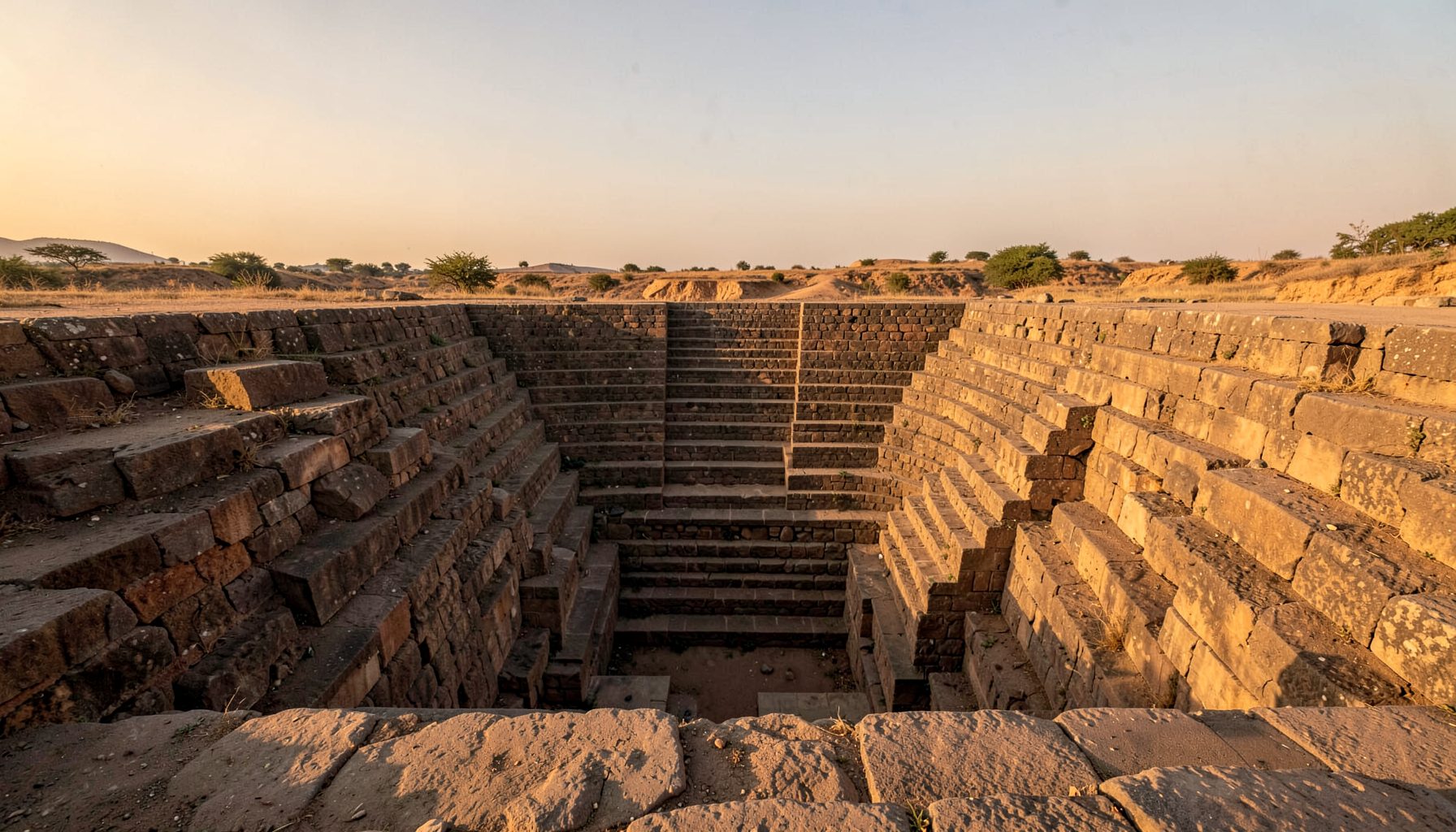
India’s stepwells are often described as architecture, but their most important story lies in water. A descent toward a well can pass through shaded courts, pillared halls and stepped reservoirs designed to receive monsoon runoff. Regional names such as bawdi, baoli, vav, kund and barav preserve local distinctions that broad labels can erase.
Stepwells and the future of heritage documentation in India are closely connected. As groundwater extraction, erratic rainfall and urban growth alter their settings, conservation needs evidence of how water moved, who maintained it and how local meanings have changed. A useful record joins fabric, hydrology, memory and environmental condition rather than treating a monument as an isolated object.
For an Australian audience, the subject offers a way to support precise field research without reducing India’s heritage to an exotic itinerary. It also raises familiar questions about public access, trustworthy digital publishing, volunteer participation and respect for living communities. The strongest projects create reciprocal value: better records for local custodians, open knowledge for researchers, and reasons for visitors to behave responsibly.
Reading stepwells as water systems
Conservation begins with a baseline that can be revisited. The Indian Stepwells archive shows how original photography, measured sketches and site-specific field notes can turn a remote structure into an intelligible record. Each image should carry a place identifier, date, viewpoint and conditions, while survey drawings should distinguish original masonry, later repairs and uncertain reconstructions.
Photographs alone cannot show performance. A stepwell may appear complete in the dry season yet conceal blocked recharge channels, damaged retaining walls or a changed catchment. Seasonal images, water-level readings and basic chemical observations can reveal whether it remains part of a living water system. Archival maps and old photographs can then be compared with the present ground, separating visible deterioration from alteration that occurred before documentation began.
Field methods that reveal hidden layers
A stepwell should be surveyed as a relationship between architecture, topography and water. Photogrammetry and drone photography can produce repeatable elevations, but operators need permission, safe flight plans and attention to nearby homes. Ground-penetrating radar may locate buried structures; non-invasive testing can help specialists understand construction without removing historic material. Basic measuring, sketching and condition photography remain essential alongside these technologies.
The field team should also record what machines cannot: the sound of flowing water, changes in shade, worn steps, festival activity and the names used by residents. Interviews with well keepers, priests, craftspeople and former users add context that can sharpen architectural interpretation. These accounts need consent, careful attribution and the option to remain unpublished when disclosure could harm a person or community.
The comparative, place-centred approach seen in Cap Interalle fieldwork reinforces the value of linking site records to landscape and community knowledge. For Maharashtra, that could mean mapping a stepwell against village tanks, percolation channels, aqueducts and contemporary settlements. Such a network reveals relationships hidden when each monument is catalogued alone and gives conservators a practical way to assess upstream and downstream impacts.
Designing a durable digital archive
The documentation mission behind Indian Stepwells makes publication a core part of preservation, rather than a final promotional stage. A durable archive needs stable pages for every site, consistent metadata, versioned survey files and a clear distinction between observation, interpretation and oral testimony. Persistent identifiers, open file formats and geographically accurate coordinates allow a record to survive changes in website design or research priorities.
Automation can help organise large collections, but human review remains necessary for place names, transliteration, dates and architectural terminology. Search should work across local aliases, English names, photographs, drawings and seasonal observations. Offline copies, encrypted backups and a succession plan for the archive are as important as the public interface; a website can disappear while its evidence still has research, conservation and educational value.
Editorial boundaries matter because every public URL affects how a collection is understood. The unrelated Italian gaming guide associated with this domain demonstrates why inherited pages need clear labels, metadata and redirects. Keeping heritage material coherent protects trust and prevents stray content from obscuring the archive’s purpose.
Placing communities at the centre
The Dead Ireland project demonstrates how independent visual documentation can bring overlooked structures into public view. A stepwell register can achieve something similar in India by identifying sites before they disappear from memory, but a visual entry should never be the whole record. Local reports may correct an incorrect map, reveal another access path or document a structure that official surveys have missed.
Community involvement also changes who defines significance. A community may value a stepwell for ritual use, drought relief, household access or family history rather than for its architectural rarity. The documentation process should record those values in the participants’ own terms, credit photographers and knowledge holders, and agree on image use before publication. Undocumented sites should enter a review process that protects precise coordinates when public disclosure could invite damage.
Access can be broad without being indiscriminate. High-resolution archives, school material and curated site interpretation can serve different needs, while sensitive chambers and vulnerable structures may require restricted access. Revenue from prints, exhibitions, grants or memberships should support survey work and community priorities. This approach turns documentation into a cycle of research, feedback and renewed care.
What Australian heritage audiences can contribute
Australian cities offer useful parallels. In Melbourne, tram travel and compact laneways make close observation of urban layers a normal part of city walks; in Sydney, ferry routes, light rail and harbour paths place historic infrastructure within everyday commuting. A public accustomed to phone cameras, geotagged images and informal walking groups can readily understand the value of recording subtle changes around a monument.
The local market also signals what responsible cultural consumption can look like. Australian bookshops, architecture fairs and Aboriginal-owned art centres often foreground provenance, artist consent and the return of value to source communities. Partnerships with Indian publishers, universities and heritage groups can support the documentation mission through limited editions, field guides and exhibition travel, provided commercial benefit reaches photographers, fixers, translators and custodians rather than stopping at the website operator.
Legislation shows why public documentation and private advocacy must operate together. The NSW Heritage Act 1977, Victorian Heritage Act 2017 and comparable state instruments create formal pathways for assessing places with historical value, while local planning controls can protect streetscapes and viewsheds. India’s own framework, including the Ancient Monuments and Archaeological Remains and Protected Areas Act 1958, differs in structure, yet both systems benefit from strong inventories, clear public evidence and sustained civic attention.
A practical documentation programme
A future-facing programme would turn individual surveys into a repeatable system. It should prioritise sites at risk, train local researchers, share equipment where appropriate and create a route from urgent field evidence to long-term conservation. The following measures give Indian and Australian partners a shared basis for action:
- Establish a standard field record with local names, coordinates, dates, orientation, weather, water level, condition grades and photographic indexes.
- Pair measured drawings and drone imagery with non-destructive investigation, archival research and a clear account of methods and equipment.
- Collect oral histories and seasonal diaries through consent-based processes that credit contributors and allow sensitive knowledge to remain controlled.
- Publish versioned metadata, stable links, open downloads and reusable images while maintaining offline backups and institutional succession plans.
- Create a community review panel for disputed names, restricted locations, image permissions and decisions about public access.
- Run rapid follow-up surveys after major rainfall, drought or nearby construction, then feed urgent findings to conservation professionals.
Success should be visible in the record and in the landscape. A well-indexed survey can reveal a lost recharge route; a funded follow-up visit can stabilise masonry before the next monsoon; a community-approved sound map can keep local knowledge in circulation. By combining rigorous documentation with shared authority, stepwell conservation can become an enduring field practice rather than a sequence of one-time photographs.
Get in Touch
Have information about a stepwell that is not yet on our map? We would be glad to document it and give you full credit. Whether it is a Barav, Kund, Vihir, or any other form of stepwell, every contribution helps preserve India's water heritage.
Call or message us with details about the location, and we will follow up.
#9372496819
Send a Message
What People Say
"The Maharashtra Stepwells campaign has brought attention to structures that were nearly forgotten. The architectural documentation and drone photography are invaluable resources for researchers and students alike."
"Collaborating with the Indian Stepwells team gave our architecture students hands-on exposure to traditional water-harvesting structures. The presentations were insightful and inspiring."
"I shared details of a stepwell near my village that was not on any map. The team visited, documented it beautifully, and credited me. It felt wonderful to contribute."